A developing El Niño is on track to take hold by June-July-August (JJA), making the 2026 Atlantic hurricane season likely quieter than normal overall. However, history says preparing for impacts from just one storm is still the best approach, regardless of the forecast.
The Numbers Drop
A swift transition will occur from neutral ENSO conditions to a strong El Niño over the next couple of months, the Climate Prediction Center says. This timing matters as it aligns with the start of the 2026 hurricane season.
The El Niño-Southern Oscillation (ENSO) is a pattern of atmospheric conditions driven by sea surface temperatures off the west coast of South America that alternates between a cool phase, La Niña, and a warm phase, El Niño. El Niño increases wind shear and reduces atmospheric instability over the Atlantic Ocean. These environmental changes make tropical storm development more difficult.
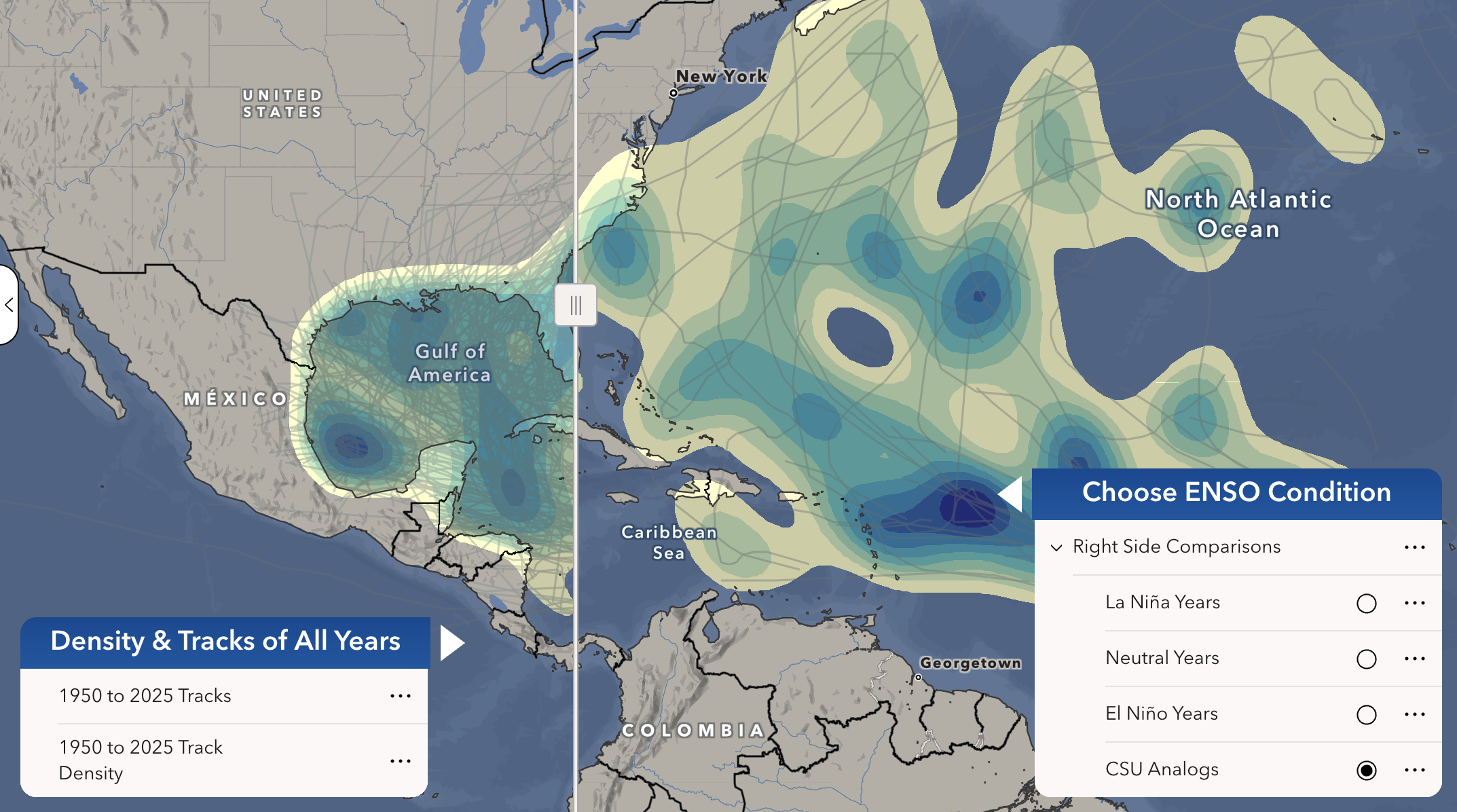
Baron Weather GIS intern Christian Bloodsworth analyzed hurricane tracks and ENSO condition data between 1950 and 2025 to compare conditions, highlighting areas of high occurrence density.
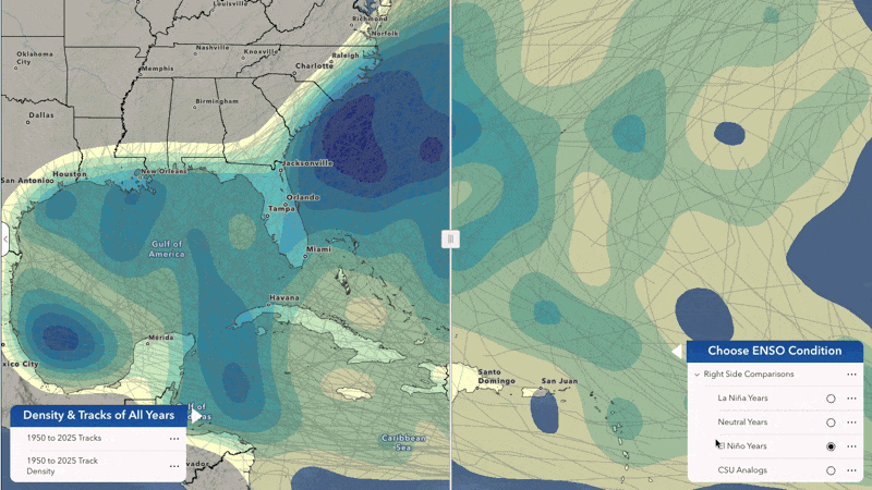
Density and track maps show the differences in named storms across different ENSO conditions. During El Niño years, notice the large hurricane hot spot off the East Coast remains. However, activity in the Gulf of America significantly decreases. The Atlantic averages 13.2 named storms during La Niña years. That number drops to 10.6 during El Niño years, a nearly 20% decrease in named storm activity.
But Impacts Still Occur
The annual hurricane season forecast produced by Colorado State University (CSU) indicates a below-average number of named storm systems. Their forecast also identifies years with similar atmospheric conditions, which include 2006, 2009, 2015, and 2023.
Three of those four years produced zero U.S. hurricane landfalls, yet people still felt the impact of tropical systems. Tropical Storm Ernesto in 2006 brought storm surge flooding of 4-6 feet along North Carolina rivers. Hurricane Ida of 2009 made landfall in Alabama as a weakening tropical storm, causing 3-6 feet of storm surge along the Alabama and northwest Florida coastline.
Two significant flooding events occurred in 2015. Tropical Storm Bill brought extremely heavy rainfall across Texas, resulting in significant flash flooding along the Red River. Hurricane Joaquin never made landfall in the U.S. but still funneled enough tropical moisture into the Southeast to produce historic flooding across the Carolinas and mid-Atlantic.
The most recent analog year, 2023, produced Hurricane Idalia, which sent record-setting storm surge ashore as a Category 3 hurricane, causing $3.6 billion in damage along Florida's Big Bend coast. All four analog years had significant U.S. impacts, regardless of the El Niño condition or whether a storm made landfall.
Risk is Always Constant
A below-average hurricane season forecast does not mean a storm-free season; one landfalling storm is enough to change lives and disrupt operations.
Now is the time to review your hurricane plan, restock your emergency supplies, and familiarize yourself with your evacuation routes. Business owners and operation managers should review continuity plans, assess supply chain vulnerabilities, and verify that insurance coverage reflects current needs.
El Niño conditions shift the odds, but preparation changes the outcomes.
